+86-20-82108930
 info@alpha-surveying.com


Alpha 40 Optic-electric RTK Supports Water Conservancy Surveying with High-Precision Laser Measurement
Time:2026-10-09 10:57:39
Alpha 40 Optic-electric RTK Supports Water Conservancy Surveying with High-Precision Laser Measurement
Since its launch, Alpha 40 Optic-electric RTK has received positive feedback from surveying professionals. Recently, we received a field report from a user at a provincial water conservancy authority, sharing their experience with the Alpha 40. Their feedback reflects strong recognition of the product's performance in real-world surveying applications.
The user applied Alpha 40 for a survey project aging water channels and hydraulic structures, where complex site conditions posed considerable measurement challenges. In their field report, they shared their experience through several typical surveying scenarios:
The feature that stood out most was the reflectorless laser measurement capability. Combined with optical calibration and integrated inertial navigation, Alpha 40 allows surveyors to measure inaccessible points such as the underside of bridges, the opposite bank of a river or channel, and building facades.
There is no need to set up a prism or enter the water. Simply aim the laser at the target to acquire survey points. With stable accuracy over short distances, tasks that previously required multiple surveyors can be handled by a single operator, significantly improving field efficiency.
During channel surveys, the opposite bank may be difficult to reach when the channel is wider than the working range of a standard survey pole. With the Alpha 40's reflectorless laser measurement function, surveyors can quickly and accurately measure points on the opposite bank without wading into water.

When surveying a tunnel portal, excessive standing water in front of the opening can make it difficult to safely access the measurement area. To avoid wading the water, surveyors can use Alpha 40's laser measurement function to accurately measure the tunnel crown, tunnel haunches, and the top edges of the channels on both sides.
This greatly improves both surveying efficiency and measurement accuracy.

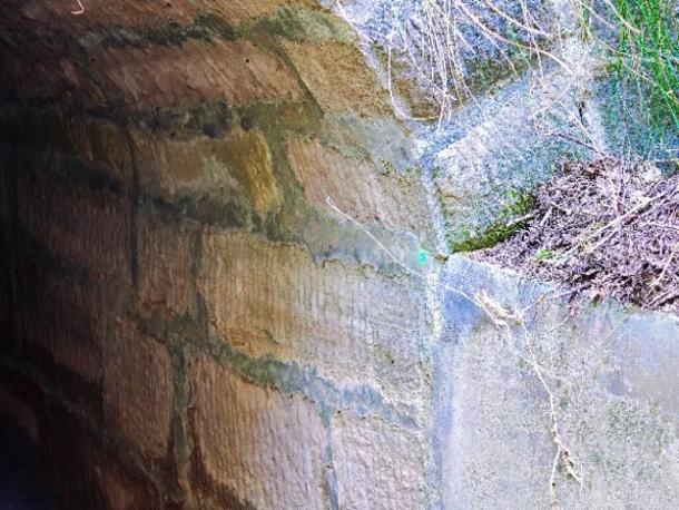
Many aging water channels are located along mountainous terrain and are surrounded by trees, creating challenging conditions for RTK surveying. However, according to the user's experience, Alpha 40 never left the survey team waiting for a fixed solution in the mountains or wooded areas.
Its compact body also reduces the physical burden on surveyors, helping to minimize fatigue during extended fieldwork. The improvement in field efficiency is clear and noticeable.

Overall, the user was highly satisfied with the Alpha 40 and summarized the key advantages as follows:
1. Wide scenario adaptability
The Alpha 40's reflectorless laser measurement breaks through the limitations of conventional RTK surveying. With a measurement range of up to 40 m and laser positioning accuracy of 3–5 cm at 10 m, it can be used for inaccessible, hazardous, or obstructed points.
This makes it suitable for a variety of applications, including municipal surveying, railway surveying, river and channel surveying, and power infrastructure surveying.
2. Dual advantages in accuracy and efficiency
By combining GNSS positioning, laser measurement, and inertial navigation, the Alpha 40 supports both accurate positioning and efficient point acquisition. According to the user's experience, single-person operation improved field efficiency by more than 50%, making it well suited to large-scale surveying projects.
3. Lightweight design
With a 680 g body and long-lasting battery, the Alpha 40 helps reduce fatigue during extended fieldwork. Its lightweight design is particularly suitable for outdoor surveying tasks that require frequent relocation.
4. Comprehensive software workflow
The Alpha 40 provides a complete range of field-surveying functions and supports compatibility with multiple software platforms, helping streamline the workflow between field data acquisition and office processing. Its straightforward workflow also makes it easy for new users to get started.
5. Stable RTK performance in challenging environments
With a 7-constellation, 24-frequency-band GNSS receiver and a long-range UHF radio, the Alpha 40 maintains stable RTK performance in challenging conditions, including areas with signal obstruction and long working distances.

点击右上角
分享给朋友吧







 Long by picture save/share
Prev : Alpha 4AR Visual RTK with Drone Mode: More Than Real-World StakeoutNext : From Equipment Rental to Field-Ready: How Alpha 4AR Supports Forestry Surveying
文章推荐


Copyright @ VillaGrandis All Rights Reserved 粤ICP备2021072613号-2 网站地图